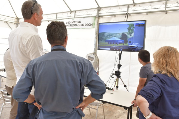
Droinwork fleet, at the service of agriculture
Droinwork is a company based in Todi (Perugia) that offers a wide range of services based on drone technology. These include video recording, of course, as well as photogrammetric surveys (to detect characteristics of a terrain that is not easily perceived at ground level), infrastructure inspections and vocational training courses. Of course, agricultural applications are also covered, where drones can play an essential role in terms of rationalization and optimization of production processes, above all thanks to multispectral remote sensing. “Precision agriculture provides for agronomic interventions based on real crop needs - explains the Umbrian company - determined by non-linear variables that are not easily observable, such as the type of terrain, lighting and microclimate. These variables significantly affect the physiological conditions of plants. But with the multispectral drone remote sensing - the company specifies - it is possible to monitor the health conditions of the vegetation in a timely manner, calibrating the processing accordingly. Thanks to the use of low altitude drones, it is possible to use a specific sensor to capture numerous multispectral images, which are then used to compose geo-referenced maps. In detail and with a colorimetric scale, these maps portray the conditions and needs of the crop in each area of the field. Thanks to the remote sensing with drones, which can be combined with traditional sampling, it is therefore possible to increase the quality and quantity of the crop, identify any biotic and abiotic stress, accurately establish irrigation and fertilization in each area, reducing the environmental impact and management costs. Compared to satellites and aircraft, drone technology has the great advantage of eliminating the disturbances produced by the filter effect of the atmosphere and solving problems related to low resolution on the ground (pixels where the mixture of vegetation, soil and shadows ends up producing inaccurate data, thus invalidating the analysis). Moreover, the very high resolution of the images allows to select and analyse only the plants of interest, ignoring all the rest.